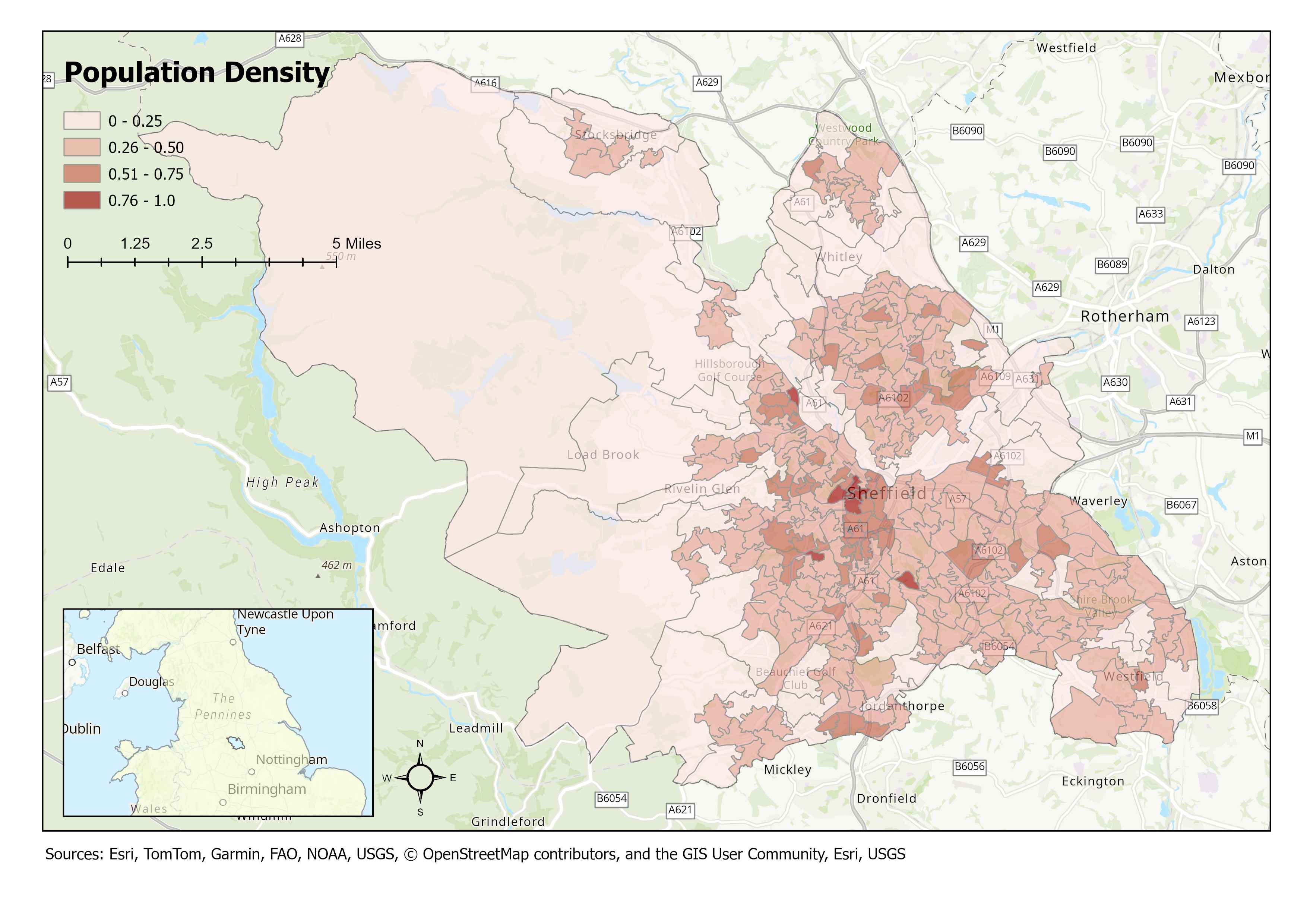
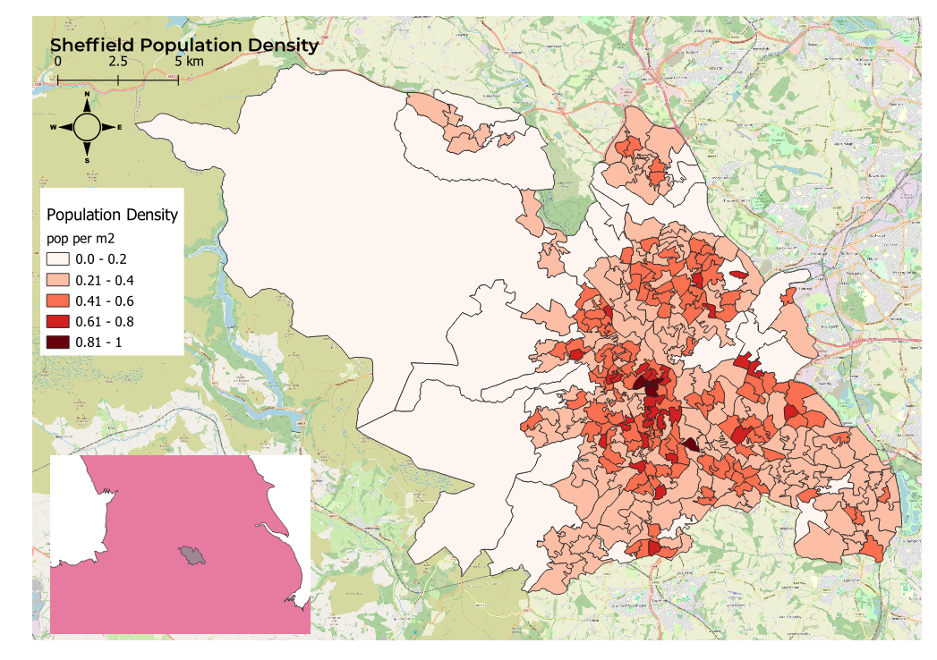
Print Layouts
The analysis is all done - and now you want to create a super lovely map as a poster for your bedroom wall!
Luckily, both ArcGIS and QGIS offer functionality to design a layout for exactly
this purpose. The functionality of the two is broadly the same, so in this artcile I prepare a simple map and "layout" to explore some of the differences between the two systems.
As elsewhere, the purpose of this document is to practice these skills and to provide a rough reminder to my future-self on where to find things when they are sneakily hidden away.
Layouts provide cartographic functionality to present a map for output in a range of formats. This might be as a PDF for printing or as an image for a website. The functionality
commonly used includes things such as giving the map a title, credits/attribution, a scale, a legend and a northing. It is possible to display multiple maps together or an inset map to give the broader geospatial context.
It's also possible to design a commmon template such that maps created by a company have the same branding and layout.
ArcGIS
As one would expect with ArcGIS Pro the number of options available and functionality is very advanced. ArcGIS comes with pre-built templates that can be used and applied very easily or you can start from scratch
to build your own.
ArcGIS allows you to create multiple maps in a project. This approach makes it straight-forward when intending to display multiple maps on a layout as these are already logically prepared and separated.
To create a layout navigate to the "insert" top menu and there is an option for "New Layout". This drops down to show possible paper sizes and orientation. Another dropdown called
"Import Layout" is located in the same area of the insert ribbon. Clicking this will reveal pre-built templates.
To insert a container for a map (known as a "Map Frame") one has to navigate to the "insert" top menu > "Map Frames" section where there is a dropdown to select from the maps
available in the project. Once selected simply drag the cursor rectangle to the size you wish the map to be and the map contents will be displayed. Right clicking on a map frame opens a context menu where properties will
open a docked dialog where settings for the frame can be configured (including changing the map itself).
To move the map around within a frame use the "activate" option in the layout ribbon. The map content can then be dragged and zoomed to best fit the frame.
It's fairly easy to add additional elements to the map as these are presented in the top ribbon often with dropdowns to easily select from a range of options/designs. The contents pane shows the layout content (drawing order) and
is an easy way to navigate around the various elements. Clicking around on the items in the contents pane will show the relevant options in the ribbon and/or one has the option to right click and select properties.
Configuration of the legend is a little fiddly as there are many options but it's pretty easy to grasp without recourse to the documentation.
Adding an insert map is very easy. Just add a another map frame, make it small and link to a pre-prepared map that would have already been formatted as a simple inset.
The only downside I see with ArcGIS is the dynamic ribbon which still seems to cause me confusion. Aside from this the process is very intuitive.
QGIS (3.34, Prizen)
In QGIS, the layout configuration is contained in the "Project" top menu dropdown. These are "New Print Layout" and "Layout Manager" - the latter opening a dialog
where previously configured layouts are listed and can be opened. This was not obvious and I had to google in order to find this.
Creating a new print layout opens up a new window that pretty much seems like a separate application entirely (a little like with geo-referencing). This is handy if you have two screens.
There are icons on the left-hand side to "add a map" and to "adjust content". These work in a similar vein to ArcGIS however on creating a map one simply gets what is currently visible inside the main QGIS map rather
that being able to select the contents. QGIS does not have the concept of multiple maps in the main app, however layers can be organised in "groups" which can act as separate maps.
From the tutorials I found online, the approach taken was generally to add a map, lock the contents of the layout, and then manipulate the original map back in QGIS to change the view (e.g. to make suitable for an inset map)
before then switching back to the print layout to add another map that defaults to this new QGIS display. I think this is a little crap in comparison with ArcGIS.
In general, I struggled with QGIS. Many options are there but not to the same level as in ArcGIS. My system crashed a couple of times and also froze so QGIS must be heavy on resources - in fact so much, that in
the end, I gave up without wasting any further time.
Conclusions
The fucntionality in ArcGIS is more advanced, and in my opinion, much easier to use. The concepts of multiple maps makes the configuration conceptually simpler.
I've been a champion of QGIS of late and have been really impressed with its functionality - having historically always really been an ESRI baby. I was therefore really surprised and dissapointed that QGIS was
not better here, although the crashes and unresponsiveness may have been a factor. I will therefore reserve final judgement and dip back into this topic once I am able to upgrade my laptop to something a little
more powerful (I suspect memory limitations were the issue here - my laptop only having 16gb and being quite old).

